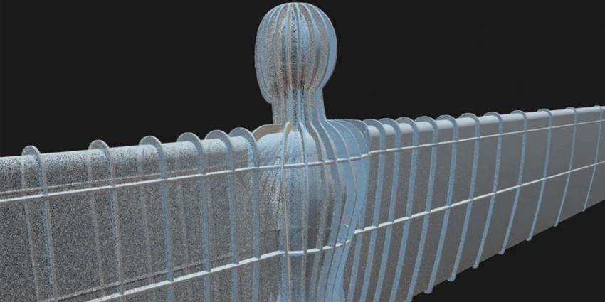

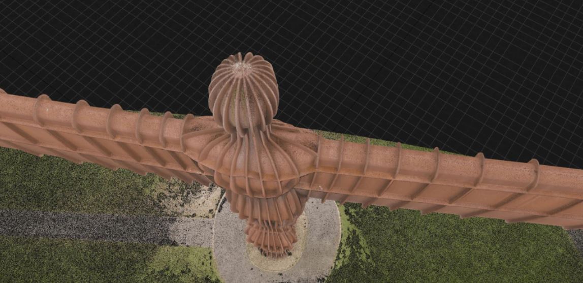
As part of an ongoing national survey, RUAS and technology partners Heliguys have digitised British Sculptor Antony Gormley’s famed Angel of the North statue, located beside the A1 road in Gateshead, England.
Commercial drone provider RUAS used a DJI M300 RTK drone and P1 camera supplied by Heliguys to capture more than 2,000 aerial images of the iconic landmark, allowing people to view the digital twin from any angle.
The high-quality real-time 3D (RT3D) model showcases the power of Heliguys P1 photogrammetry camera and displays the advantages of using drones and digital twins for surveying.
To capture over 2,000 aerial images, RAUS employed a two-pilot team using Heliguys’ Operating Safety Case system, which permits drone pilots to work outside of the standard permissions set by the UK Civil Aviation Authority. Therefore, the RUAS team could reach the statue in ways not seen before.
Also, the team used a mixture of automated and manual capture methods to build a detailed digital twin based on the drone-captured data.
According to Heliguys, the high-quality Angel of the North digital twin is a crucial example of using drone-based photogrammetry to conduct remote inspections and surveys.
RUAS creates digital twins and RT3D models for industrial use cases in vertical markets such as transportation, infrastructure, construction, and defence.
The Newport-based firm is also working to preserve iconic UK monuments digitally, and The Angel of the North digital twin is the first step in realising this vision.
Photogrammetry for Industry
Heliguys is supplying drone technology to many industries for various use cases. Firms employ Heliguys hardware to create digital twins of places and objects.
The firm’s lineup of photogrammetry-ready ‘DJI’ drones enable firms to digitise real-world data accurately. Companies can efficiently perform photogrammetry, 3D mapping, and topographic surveying by capturing data from above.
Also, Heliguys drones use LIDAR scanners, powerful cameras that detect the distance between two objects to create RT3D models of a landscape or object, to collect survey data 97 percent faster than manual methods.
Last year, Anarky Labs and Flyby Guys created photogrammetry drones with built-in Microsoft HoloLens 2 technology that enables AirHUD, an augmented reality (AR) solution that displays key info for pilots such as live headset updates, indicating the drone’s location, direction, battery, and GPS data.
Other firms such as the Bristol-based Spatial Hawk also use drone and satellite imagery to create 5G-enabled RT3D spatial data of interiors and exteriors to support several key industries.